Patagonia
Hiking the W in Torres del Paine
Illustrations, Photographs and Words by Nathan Waak
Not sure when I got the idea for this adventure, although I’m fairly sure it started while sitting on the couch watching a nature program and eating a block of cheese. Whatever that first nudge was, the trip would take me to the edge of the world and to the edge of my physical abilities.
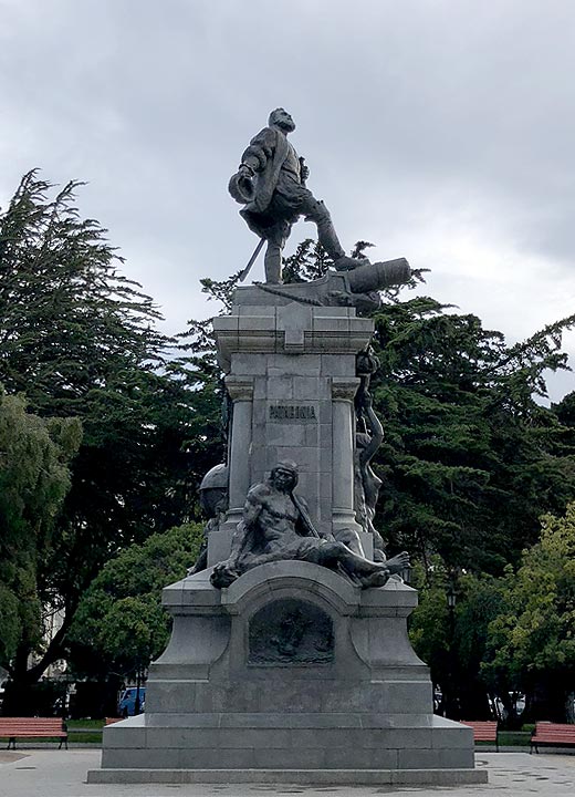
Statue of Ferdinand Magellan.
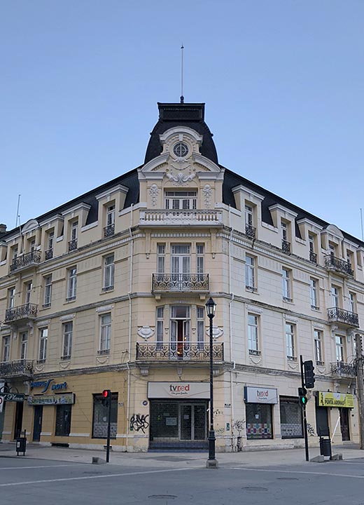
Plaza Hotel located on the main square.
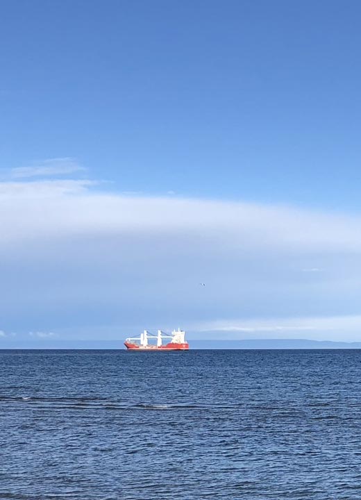
Large ice breaker on the Staight of Magellan.
My journey started with three flights lasting a total of 25 hours, from San Francisco to Dallas to Santiago to Punta Arenas. As I was landing in Santiago, it must have been burn pile day or they just don’t care about air pollution because the smog was thick and the odor pervasive. There was a three-hour window from when I landed in Santiago and my flight to Punta Arenas. One would think this would be more than enough time, however, between immigration, customs, and navigating a chaotic terminal with signs in a foreign language, I barely made my flight.
It’s a quick flight from Santiago to the Punta Arenas airport, which is about 20 minutes from town. I grabbed a taxi to my hotel, checked in, and took a walk around. Punta Arenas is a medium-sized town located on the Straight of Magellan. On the Saturday afternoon I arrived the locals were out shopping en mass. One thing I noticed right away was that the men all wore the same cologne, and they put on buckets of this stuff. The main square has a statue of Ferdinand Magellan and for good luck one should kiss the toe (I opted to avoid getting the plague and just touched the toe). Around the main square are a variety of government buildings, hotels, restaurants, and retail stores.
I meandered down and took a stroll along the Straight of Magellan, a natural passage some 350 miles long and 2 miles wide between the Atlantic and Pacific oceans. There I spotted numerous fishing boats, tankers, and mix of sea birds. And everywhere you go there are stray dogs. The dogs and their nemesis, the automobile, do a strange dance. The cars will slow just enough and honk at the dogs while the dogs will bark and sometimes even give chase. In the 20 or so encounters I saw, not a single dog was hit. The weather began to change and I was still tired from traveling, so I headed back to my hotel for a whiskey and a steak before calling it a night.
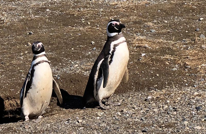
Magellanic Penguins
The big adventure for today was going to the Magdalena Island, home to some 30,000 Magellanic penguins. After taking an hour-long boat ride into the Straight of Magellan you dock and walk on a looped path around the island. The penguins are quite relaxed around humans, as long as you stay on the path. In some cases when you take a photo they will twist their heads in curiosity.
Male and Female Magellanic penguins.
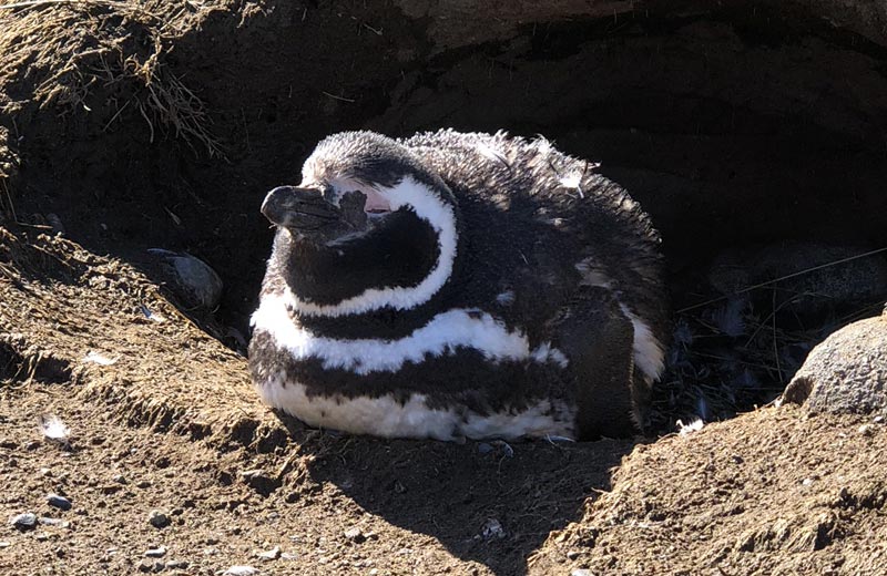
A Magellanic penguin resting on the edge of the ground nest.
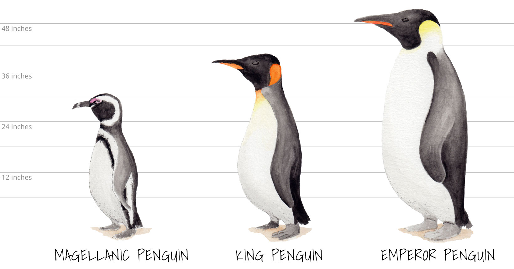
Magellanic penguins are smaller than the more famous King and Emperor penguins. They are about 30 inches high, they mate for life, and come back to the Magdalena Island for breeding each year. Towards the end of March the penguins begin to leave the island and head to warmer waters near Brazil. They return in late October and the mated pair has one chick a year, which both parents take turns feeding until it is old enough to leave the nest, so to speak.
Into Patagonia
The trekking outfit picked me up along with another 15 individuals and we headed to Puerto Natales, a good three hours north of Punta Arenas. I stayed with this group of 15 other trekkers along with three guides for the next 9 days.
At least half of these hikers have climbed Mt. Kilimanjaro, two had made it to Everest base camp, and those who had not proved their fitness by scaling a large peak or two, are marathon runners—as in they run a couple or four marathons a year. These are the type of people that will go for a “quick” run after we had hiked all day. There was one other person, like myself on the hike that did not quite fit into the above categories, but he was only 30 and had youth on his side. Needless to say, I was not on their level.
The land between Punta Arenas and Puerto Natales starts out flat and grassy, then there are some rolling hills, but still quite barren, very similar to eastern Colorado. As the land turns to larger foothills it also goes from scrub brush to full-grown southern beech trees. As you get to Puerto Natales, in the distance and across the Señoret Channel you can see mountains with snowcaps. During the drive I spotted a number of animals including guanacos, Chilean flamingos, rheas, southern crested caracaras, one gray fox, grazing cattle, and hundreds of sheep.
Upon arriving in Puerto Natales I took a walk along the Señoret Channel and got my first taste of the true wind, rain, and coldness of Patagonia. Up until then, I felt my clothes might be too heavy, but the wind blew right through three layers and my eyes teared up so acutely I could barely see. That night we had a welcome dinner and I got to know my fellow trekkers over pisco sours and salmon stuffed with scallops.
Mylodon Cave
I started the morning with a walk around Puerto Natales, which is small, clean town centered between the main square and the Señoret Channel. Most of the businesses deal in tourism of some kind, either selling trekking supplies, offering day trips or longer expeditions, and there seems to be a hotel or hostel on every corner. Bars on the other hand are not as numerous, but the hotel I stayed at had a great one, and really you only need one good bar.
Puerto Natales was founded in 1911 mainly as a port for the sheep industry. When that declined the city started exporting coal from Argentina, being as it is only about 10 miles from the border and the closest port. As the coal mining operations began to diminish in the 1990s, tourism started to become the main industry. There are worries among locals that Puerto Natales will be transformed with this latest economic change, especially now that the airport has started offering daily commercial flights. As for now, the bars still pour a good three finger whiskey and that’s a great gaucho character to have.
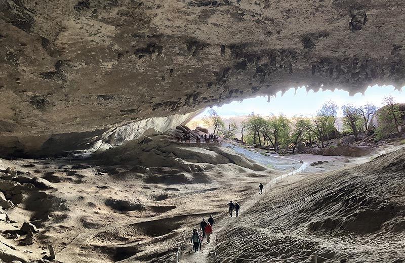
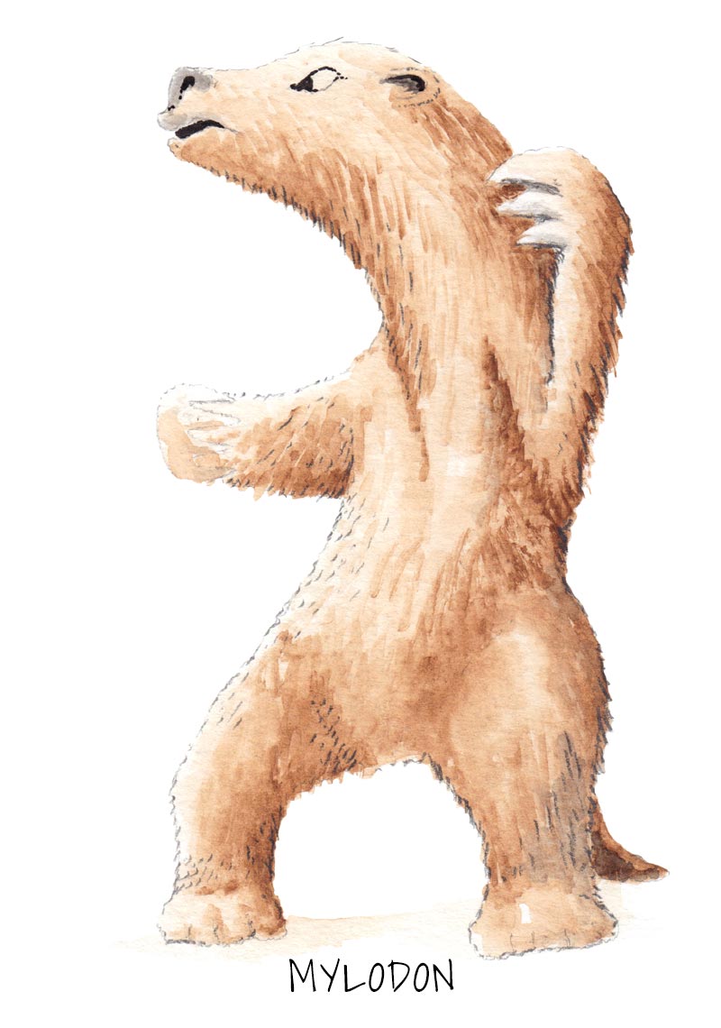
At mid-morning the group hopped into two vans and headed to the Mylodon Cave where fossilized remains of the giant sloth were found in 1895 by Hermann Eberhart, a German explorer of Patagonia. The Mylodon was about the size of a large bear and went extinct about 10,000–14,500 years ago. This ancient relative of the modern-day sloth walked on all fours, weighed about a ton, was approximately 9 feet from head to tail, and was covered in thick fur.
The cave where the remains were found is quite large, with the entrance being some four to five stories high and a good half city block wide. Layers of sandstone and conglomerates, composed mainly of sediments of small stones makeup the walls of the cavern. This gives the cave the appearance that it was cast out of shoddy concrete and could collapse at any moment, thus keeping one conscious of how far it would be to run to safety.
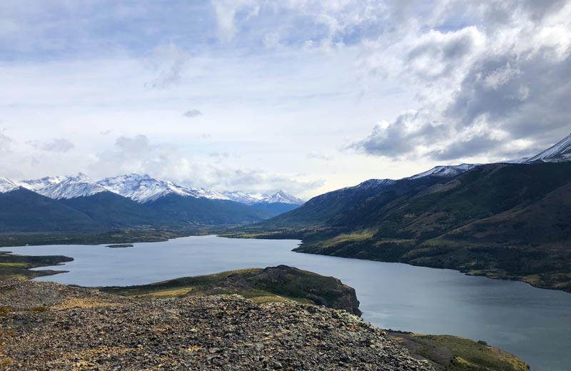
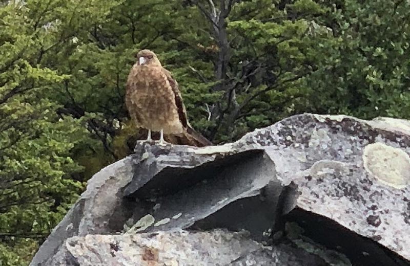
Next, we headed about 30 minutes north to a hiking trail near Sofia Lake. The ascent took us up to a beautiful vista with mountain ranges as the backdrop. Along the way I spotted a pair of Andean condors soaring high above. These are some of the largest flying birds in the world, with a wing span of about 10 feet and they can live up to 70 years. After lunch in a sheltered valley, we headed back to Puerto Natales for dinner and drinks.
Looking out of the Mylodon Cave.
Sofia Lake and the Arturo Prat mountain range.
Serrano Glacier
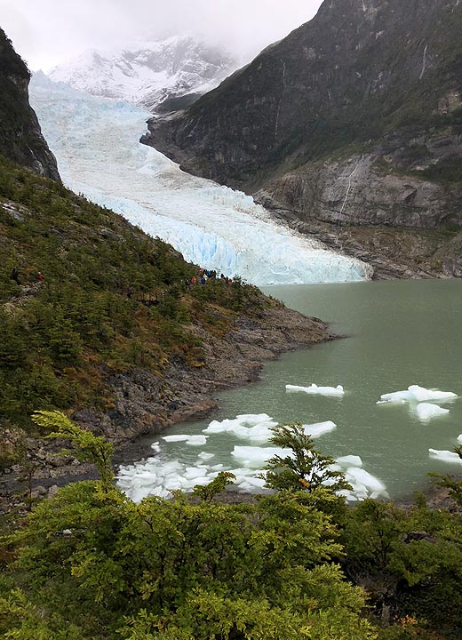
Today we left Puerto Natales via a ferry style boat into the Última Esperanza Fjord. Along the way we passed some of the oldest cattle and sheep ranches in Patagonia. These ranches are very isolated even today with only boat access. As the ferry headed north there was a colony of hundreds of cormorants, which at first look like penguins, but once they take flight you know they are a different species. Then up ahead appearing through the low clouds was Monte Balmaceda and the glacier leading off its eastern side. This glacier is in full retreat because of climate change and no longer reaches the fjord as it did in the 1980s.
The ferry docked at Puerto Toro. From there we hiked to the Serrano Glacier, which is part of the Southern Patagonian Ice Field. As I hiked into the woods and next to the lagoon the clouds began to lift and the entire glacier came into view. One cannot get onto the glacier and this became obvious as I got within a 100 yards and huge chunk came loose, collapsing into the lagoon with a deafening sound.
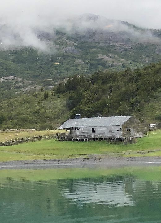
Old cattle ranch dated to 1887.
Leaving the Serrano Glacier we donned survival suits, these are needed in case you go overboard, the suit will give you a good 10 to 15 minutes before hypothermia sets in and you die. Once in our protective shells we got into two Zodiac boats, which took us up the Rio Serrano at speeds of around 40 mph to Punta Alta for lunch.
There we dined on lamb and potatoes, with a few, and I do mean a few, vegetables. Most of the meals consist of a large meat portion (either lamb or fish) and some type of potato. Fruit is served at breakfast, but not at other meal times. And I’m not sure if anyone has explained to the cooks that a real salad consists of more than a few wilted leaves covered in oil and vinegar.
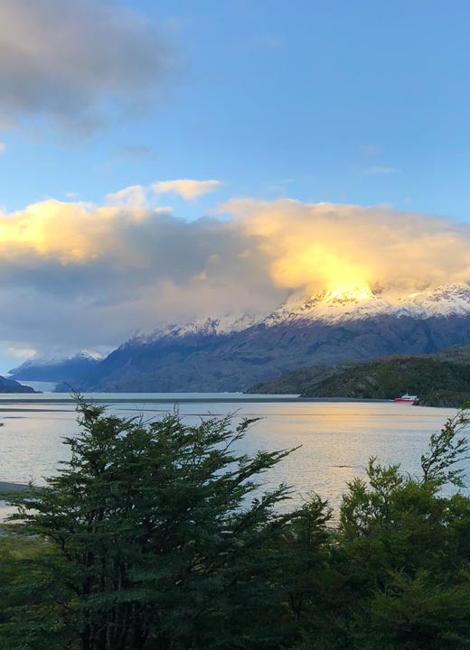
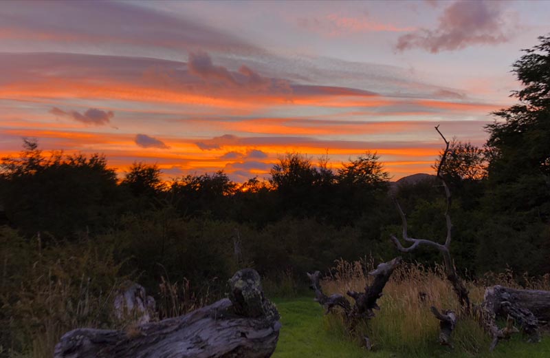
After filling our bellies we hopped into vans and headed deep into Torres del Paine National Park to spend the night at Hotel Lago Grey. As I sat and enjoyed a much-earned whiskey at the hotel, the sun slowly set and turned the mountains peaks from white to a gorgeous golden yellow.
Starting the W
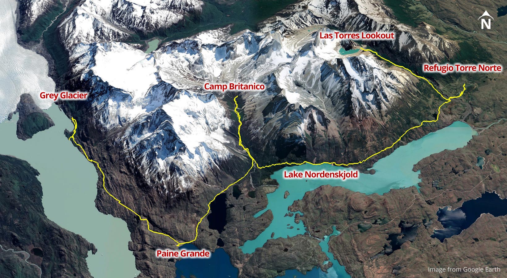
Today we start hiking the W. The W is named for the shape it creates on the map. The traditional way, and the way we were following is to start at Grey Glacier, hike down to Paine Grande, then head up the French Valley to Camp Britanico and back down to Lake Nordenskjold, then along Lake Nordenskjold to Refugio Torre Norte. The last leg of the W is up to the towers or Las Torres Lookout.
In order to get to the ferry that takes us up Grey Lake to the start of the W, we first had to hike two miles across a rocky windswept beach. The wind was blowing between 40-50 mph, so much so that my backpack felt like a sail, little did I know this was going to be the easiest part of the day’s hike. To make matters worse and because I’m an idiot, in the morning I decided not to offload 10 lbs. of gear to the porters, like everyone else.
Grey Lake is so named because of the coloring of the sediment left behind by the glacier. The water was dotted with large icebergs and the sediment in the lake suppresses aquatic life. At the north end of the lake, we disembarked the ferry and began hiking up to a point where we could get a better view of the Grey Glacier. The glacier has retreated quite far over the past 30 years and is expected to quicken its retreat as the climate continues to warm.
In 1990 the Grey Glacier covered this entire area all the way up to the tree line. Approximately, 16 square miles of ice has melted in 30 years.
Though I had trained for a year, I was still a good 20 lbs. overweight and, well, I never trained in this type of environment. My training was on San Francisco hills and nearby mountain trails, both of which are relatively easy to walk on and at a much lower elevation. Patagonia offers its own type of torture. The weather changes on a dime and changes from minute to minute. The paths are not what you would call paths. Most trails are made up of softball and bowling ball sized rocks, which you either step on or around. There is the eternal climbing up and down muddy parts, scrambling over loose gravel, and walking through streams. All this with a 30-40 lb pack on your back. It gets even more abysmal as the group spreads out and you lose track of the person in front of you, like I did a number of times. When this happens the only way to know if you are on the right path is by locating little painted sticks every 200 yards or so. It was on just such a trail that we set off to hike for over 11 miles.
The only thing that makes all this pain worth it are the views and the feeling in your soul. As Peter Matthiessen remarked while traveling in Patagonia, “The sun has been obscured, or rain has made photography impossible, as if the mystery of these places was better preserved in one’s mind and heart than on the flat face of celluloid. If one depends on a photograph to recapture the feeling of a place, disappointment is inevitable.”
As the day wore on, I began to have stomach issues. I believe there were two reasons, one I wasn’t drinking enough water, and two the meal I had the night before may not have been cooked fully. Whatever the reason, my backpack felt like a ton and I dropped back even further from the rest of the group. One of the guides stayed with me and offered to take some of the gear in my backpack. All I wanted to do was get to the refugio, which are hostel-style lodges with shared rooms and facilities, where I could use a clean toilet and sleep.
By the time I dragged my ass into the refugio for the night, all I could do was untie my boots, eat a few bites, and take out my contacts. I passed out in my bunk fully clothed with my glasses on and slept like that for the next seven hours.
Entering the French Valley
My training did pay off in the fact that although I awoke with a sore back, I was rested and ready. And to prove I can learn from my mistakes, this time I offloaded 10 lbs to the porters. The plan was to do the center part of the W today.
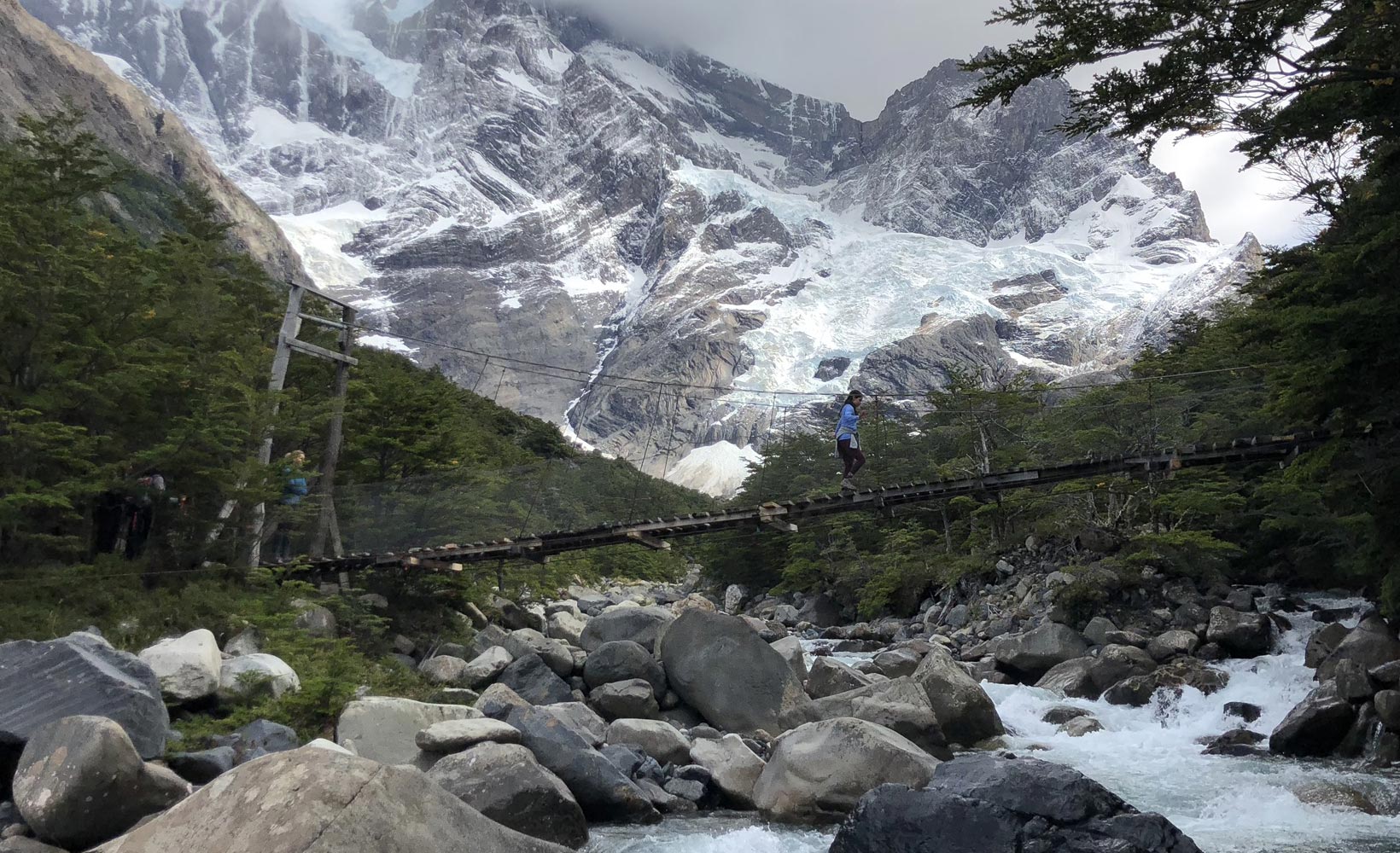
The path up the French Valley is a tough trail with 1,600 feet of elevation gain. Once in the valley you hear and see ice avalanches about every five minutes. This is an interesting sight as you can see how the ice builds on the thin peaks, then when the mass becomes too much, a large portion will dislodge and come tumbling down with the sound of a jet engine. The avalanches are on the other side of the valley, about four to six miles away, so you are never in any real danger.
After having lunch on a sunlit plateau, we hiked down to Domos Frances on the edge of Lake Nordenskjold where we had dinner and spent the night.
Looking into the French Valley.
Transition Day
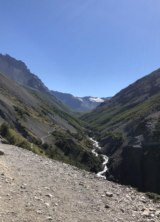
The hike today was a transition from the center to the final leg. The path was exposed to the sun and the day was warm with little to no wind. On the south side of the path is Lake Nordenskjold, a gorgeous turquoise blue body of water 20 or so miles long. The north side consists of granite mountains and waterfalls.
This was the first day where I felt at home hiking. Both the trail and the temperature reminded me of California in the spring time. Plus, I had finally adjusted to the weight of my pack and the daily distances. Throughout the day I spotted many birds, but the real treat was seeing seven Andean condors flying together.
As you near Refugio Torre Norte you can see the towers off into the distance for the first time, and as we walked into the main camp grounds the sun was setting, creating a halo effect behind the towers. That night we dined early because in order to make the day hike up to the towers and back you must start before sunrise.
Panoramic view of Lake Nordenskjold.
The Towers
Starting before sunrise, we quickly had our breakfast and hit the trail for today’s 14-mile hike. The first bit is up a mud pack trail to the Windy Pass. From there you get a good view of the valley we were going to be ascending to reach the towers. It’s a beautiful valley with a large fast-moving river in the center. I think Lady Florence Dixie described the valley perfectly in Across Patagonia: “Its steep slopes towered up on either side of us to an immense height; and the sunlight being thus partially excluded, a mysterious gloom reigned below, which, combined with the intense, almost painful silence of the spot, made the scene inexpressibly strange and impressive.”
After the Windy Pass we descended into the valley, crossed the river, and passed Camp Chileno. From there the trail steadily climbs through a dense wooded area. After hiking for about three hours you are through the woods and the trail becomes very steep with a lot of loose gravel. By now it was late morning and the temperature was beginning to increase. The last little stretch, about 1,000-1,500 yards was the toughest. The climb was over rocks, as in boulders the size of cars. Then, finally, as you come around a gigantic boulder you can see the tower tops. After a few more minutes of climbing you can see all of the towers and the lagoon below them.
Las Torres Lookout or The Towers.
The first glimpse of the towers is awe-inspiring moment, one that is indescribable partly because of the feeling you get from the place and partly from the accomplishment of climbing up to such a remote spot. It made for the perfect spot to have lunch while admiring the view and reflecting upon oneself.
Coming down was even harder than going up. The boulder section was quite difficult and you had to use trekking poles to ease yourself down from section to section. Plus, it was now mid-day and the sun was making this exposed area unbearably hot. What struck me were the people climbing up. The trail had become absolutely packed with hikers of all ages. Some of these individuals had only one small water bottle, and in a few cases they had none as if they were on a stroll through the park. It was the older people that surprised me the most. I passed a dozen or so people that had to be in their 80s, climbing up this steep path with no poles and wearing only flimsy shoes. One of our guides explained that this is such a problem they close the trail at 4:00 pm just to ensure everyone gets down before the sun sets.
Once you are back in the wooded area, the trail was very pleasant and relatively easy. There was still one large climb back up to the Windy Pass, but after that it was all down hill and back to Refugio Torre Norte for the night. With the big hike complete, I polished off a few whiskies and had a lively conversation with my new friends.
Looking into the valley from Windy Pass.
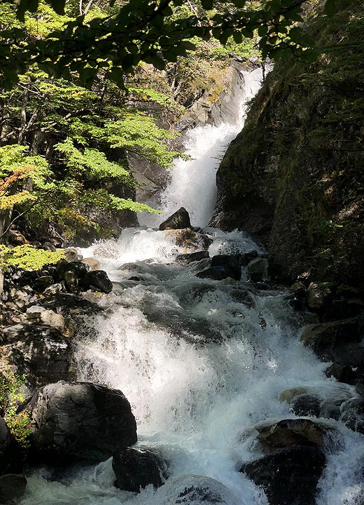
One of the many waterfalls along the trail.
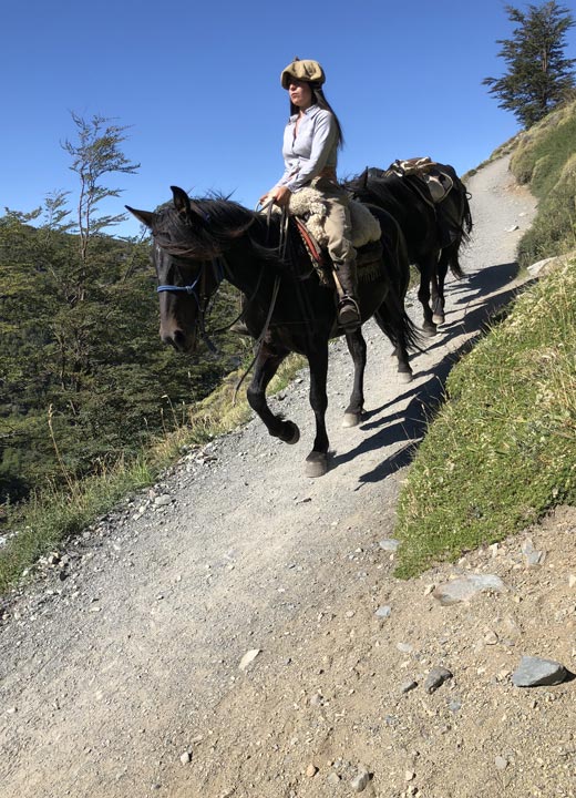
Horses transport goods to Camp Chileno.
Guanacos and Cave Paintings
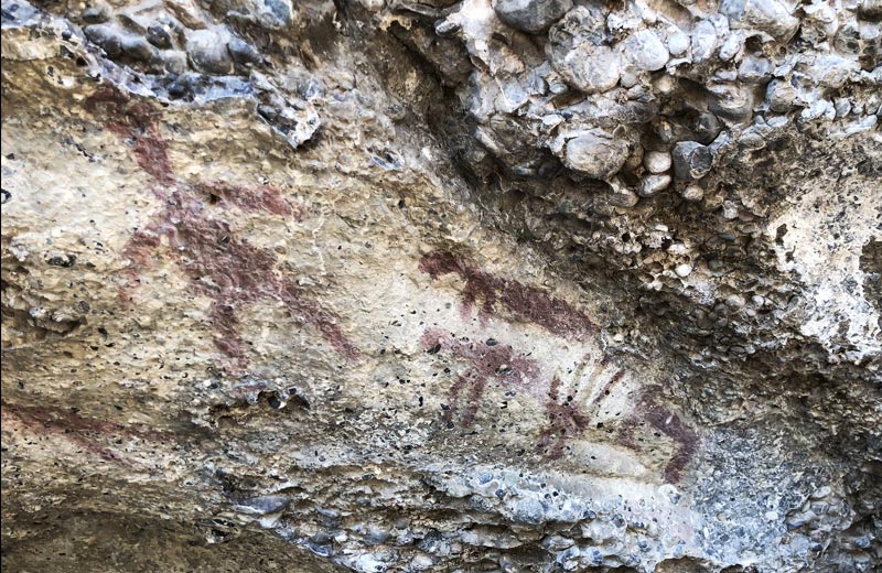
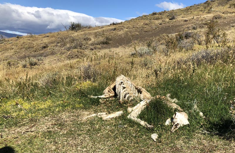
It’s always good to do a minor hike the day after a strenuous one, so we headed off to look at guanacos and perhaps spot a puma as well. The trail today took us through a wind-swept area of rolling hills. The guanacos were everywhere and as we kept an eye out for a puma the trail took us up to cave paintings dated to 6,500 BC. There were only five paintings, but they were still impressive. They were created by the Tehueiches who inhabited the Patagonia area as early as 11,000 BC. While we never did see a puma (which I think was for the best), we did come across the carcasses of guanacos who had been attacked and eaten by pumas. After the short, easy hike, we hopped into the vans and headed back to Puerto Natales for the night and the last group dinner.
Cave paintings created by the Tehueiches.
The remains of a guanaco.
Patagonia is truly a one-of-a-kind place and you can experience it in a variety of ways. In fact, you can do much of the trip I did without even backpacking, although there is no easy way to get to the towers, and nor should there be. Some places on this planet should stay secluded and formidable. These are the places that inspire us to go further and try harder—and ultimately make us a better person.
Patagonia: Hiking the W in Torres del Paine
Illustrations, Photographs and Words by Nathan Waak
Copyright ©2019 by Nathan Waak
All rights reserved. No part of this publication may be reproduced or transmitted in any form or by
any means, electronic, or mechanical, including photocopy, recording, or any information storage
and retrieval system, without permission in writing from the publisher.